UgCS Photogrammetry tool for UAV Land surveying missions
Unmanned Aerial Vehicle (UAV) technology is revolutionary in terms of capability, precision and efficiency for monitoring and mapping services. Such development has led to increased UAV usage for land surveying with photogrammetry technique.
Main UAV advantages compared to traditional survey solutions:
• Faster data acquiring,
• Data quality is exceptional and continuously improving,
• Cost saving and possibility to use commercially available non-expensive UAVs and
cameras,
• Can be operated in most difficult terrain, with ease.
UgCS is the best software to plan and fly drone survey missions, it supports almost any UAV platform, providing convenient tools for areal and linear surveys and enabling direct drone control. UgCS enables professional land survey mission planning using photogrammetry technique.
How to plan photogrammetry mission with UgCS
Standard land surveying photogrammetry mission planning with UgCS can be divided in following steps :
1. Obtain input data
2. Plan mission
3. Deploy ground control points
4. Fly mission
5. Image geotagging
6. Data processing
7. Map import to UgCS (optional)
Step one: Obtain input data
To reach the desired result, first – input settings have to be defined:
• Required GSD (ground sampling distance – size of single pixel on ground),
• Survey area boundaries,
• Required forward and side overlap.
GSD and area boundaries usually are defined by the customer’s requirements for output material parameters (for example by scale and resolution of digital map). Overlap should be chosen according to specific conditions of surveying area and requirements of data processing software. Each data processing software (e.g., Pix4D, Agisoft Photoscan, Dronedeploy, Acute 3d) has specific requirements for side and forward overlaps for different surface. To choose correct values, please refer to documentation of chosen software. In general 75% forward and 60% side overlap will be a good choice. Overlapping should be increased for areas with small amount of visual cues – for example for deserts or forests. Very often aerial photogrammetry newbies are excited about the option to produce digital map with extremely high resolution (1-2cm/pixel) and use very small GSD for mission planning. This is very bad practice, as small GSD means longer flight time, hundreds of photos for each acre, tens of hours of processing and heavy output files. GSD should be set according to output requirements of the digital map. Other limitations can occur. For example, GSD of 10cm/pixel is required, but it is planned to use Sony A6000 camera. Based on mentioned GSD and camera’s parameters the flight altitude would be set to 510meters. Problem is, that in most countries maximum allowed altitude of UAV’s (without special permission) is limited to 120m/400ft AGL (above ground). Taking in account maximum allowed altitude, the maximum possible GSD in this case could be no more than 2.3cm.
Step two: Plan your mission
Mission planning consists of two stages:
• Initial planning,
• Route optimisation.
Initial planning
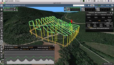
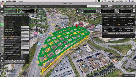
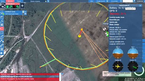
First step is to set surveying area using Photogrammetry tool. Area can be drawn using visual cues on underlying map or using exact coordinates of edges. The result – survey area is marked with yellow boundaries







Reviews
There are no reviews yet.